Skip to Main Content

Hikes with Splendid Waterfalls

Waterfall view

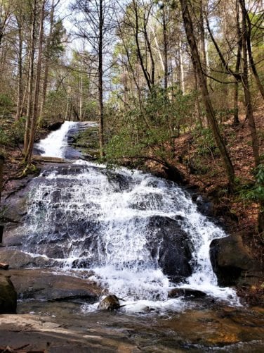
Fall Branch Falls

A must do hike for the entire family! Emerald green Mountain Laurel and Rhododendron line the half-mile moderately easy trail to the falls. An extremely popular trek for tourists and locals alike, resting benches have been strategically placed along the trail.

As you descend to the viewing platform at the bottom of the falls, you’ll begin to see glistening cascades of white water surging down the 100-foot rock cliff.

If a longer hike is desired, continue beyond the falls northward on the Benton MacKaye Trail towards Rocky Mountain. You are in for a hearty climb and then a long downhill over Scroggin Knob to BMT’s Weaver Creek Road parking area – the hike is 6.2 miles (one way).

In the spring, Catesby’s Trillium, Grandiflora Trillium Wakerobin, May Apples as well as lush Cinnamon ferns litter the landscape along the approach to Rocky Mountain.

Be sure to take the side trail (adjacent to the Rocky Mountain sign) to the top of the mountain. It’s the perfect picnic spot and, when the trees are bare, the views from here are fabulous!

As you continue your journey on the BMT, you’ll pass several gardens of the delicate Pink Lady Slipper orchids, groves of Mountain Laurel and Rhododendron as well as vibrant Flame Azaleas. Rock cairns mark the remains of an old homestead site.

Resting benches, steps and the viewing platform were constructed by members of the Benton MacKaye Trail Association. Learn more about Donating to this and other trail projects.

Map of both falls locations and road access are available at the Fannin County Welcome Center, open seven days / week in Blue Ridge.

Fall Branch Falls Trail Information

  • Distance: 0.5 miles, or for the longer hike to Weaver Creek Road, 6.2 miles (both mileages are one way).
  • Difficulty Rating: Easy / Intermediate.
  • Benton MacKaye Trail Section # 6 — if you continue for the longer hike, 6c and 6d.
  • Dog Friendly? Dogs on Leash Allowed.
  • Recommended Guide Book: Benton MacKaye Trail Guide – GA.

See onX: Hiking Project for map and additional details:

Fall Branch Falls

6b-6d Stanley Creek Road to Weaver Creek Road

Check for the latest trail conditions HERE.

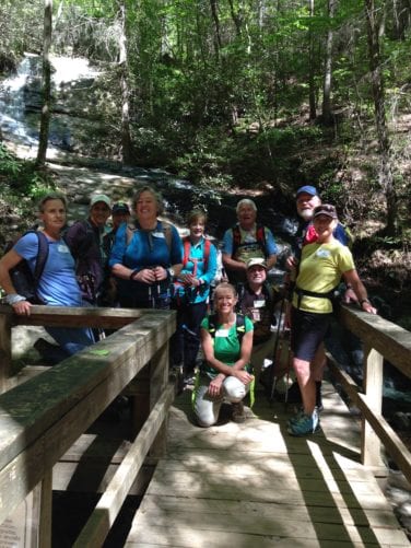
hikers at fall branch falls
Short View

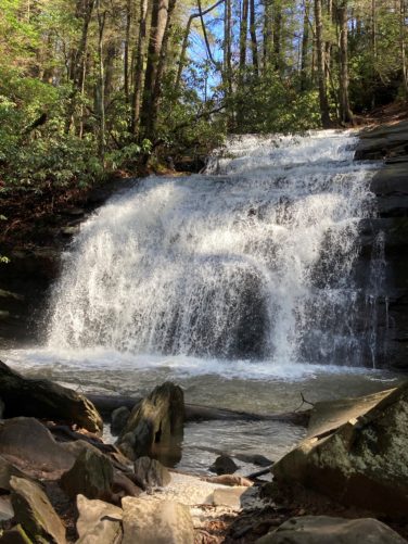
Long Creek Falls

A popular destination for day hikers, this is an awesome choice for a fairly easy, kid friendly two-mile day hike! Meandering creeks as well as abundant flora and fauna also have made this area a favorite with backpackers, fishermen and campers.

Initially you’ll stroll through a corridor of dead and dying Hemlock trees which gives way to bouquets of New York ferns, violets and pungent Galax.  As the elevation increases, you’ll notice more hardwoods and then travel thru Rhododendron thickets as you descend to the falls.

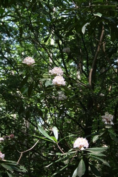
For most of the way you’ll be serenaded by Long Creek as it bubbles over and around the rocks, finally giving way to the roar of the falls as voluminous cascades of water pour down the 50-foot high sheer rock cliff. Numerous stands of emerald green Rhododendrons provide a stunning contrast to the white water rushing down the rock wall.

When you arrive at the intersection where the AT and BMT take their separate routes to the north, you’ll see the side trail to the falls.

Be sure to bring a picnic lunch – just 100 yards up the side trail to the left, is the perfect spot for a picnic!

If a longer hike is desired, you can continue another 7.8 miles on the Benton MacKaye Trail to the famous Toccoa River suspension bridge over the Toccoa River. The bridge spans 260 feet and is the longest suspension bridge east of the Mississippi. The banks surrounding the bridge are the ideal place for a picnic lunch.

The parking area for your shuttle is about a quarter mile beyond the bridge.

Before you set out on the trail consider becoming a member of the Benton MacKaye Trail Association and support the efforts that make your hike possible. Become a Member

Long Creek Falls Trail Information

Check for the latest trail conditions HERE

For a day hike:

  • Distance: 2 miles.
  • Difficulty Rating: Easy.
  • Benton MacKaye Trail Section #: Section 2a and 2b.
  • Dog Friendly? Dogs on Leash Allowed.

Recommended Guide Book: Benton MacKaye Trail Guide – GA Section.

See onX: Hiking Project for map and additional details:  Long Creek Falls Hike.

For a longer hike:

  • Distance: 8.8 miles – Shuttle required.
  • Difficulty Rating: Easy / Intermediate.
  • Benton MacKaye Trail Section #: Section 2a, 2b and 2c.
  • Dog Friendly? Dogs on Leash Allowed.

Recommended Guide Book: Benton MacKaye Trail Guide – GA Section.

See onX: Hiking Project for map and further details: Long Creek Falls Hike – BMT 2a-2b and Hike to Suspension Bridge.

rhododendron at long creek falls