Benton MacKaye Trail Association
…
Mission Statement
To preserve, protect and maintain the Benton MacKaye Trail.
Motto
“… leaving a footpath for generations to follow.”
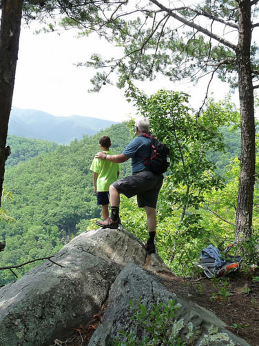
To preserve, protect and maintain the Benton MacKaye Trail.
“… leaving a footpath for generations to follow.”
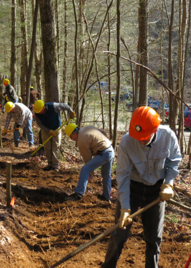
The Association was organized for the following charitable and educational purposes: to construct, maintain and protect the proposed Benton MacKaye Trail; to inform (by newsletter, brochure, correspondence, guidebook, map, and other means) its members and the general public of opportunities for outdoor recreation and public service; to conduct workshops, seminars and work trips to foster skills in trail construction and maintenance; to promote hiking, camping and a wilderness experience in the Southern Appalachian Mountains; to instill in its members and the general public a conservation ethic.
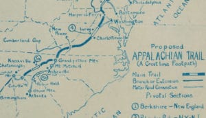
Benton MacKaye Trail Association founding member, Dave Sherman, first conceived of the idea for the Benton MacKaye Trail in 1975. A serious student of conservationist and regional planner Benton MacKaye’s life and career, Sherman was intrigued by MacKaye’s proposed spur trails that would extend the Appalachian Trail (AT) further to the south.
Sherman eventually proposed a new trail that would follow the high ridge running south along the Tennessee-North Carolina border between the Smoky Mountains and the Cohutta Mountains in northwest Georgia. The trail then continued east to what is now the terminus of the BMT on Springer Mountain.
Sherman’s idea of a sister trail to the AT, later named for Benton MacKaye, caught on and the Benton MacKaye Trail Association (BMTA) was officially formed in 1980.
Working closely with the U.S. Forest Service, the all-volunteer BMTA workforce began to build the trail … first in Georgia, later along the Tennessee / North Carolina border and eventually extending to the Smokies. Saving time and effort by piecing together existing trail segments and old logging roads, the trail was completed to Double Spring Gap on the Georgia / Tennessee line in 1989. Over the next 15 years, the association implemented a massive effort to complete the trail to the Smokies. Soon thereafter, the National Park Service agreed to piece together a route through the Great Smoky Mountains National Park to Davenport Gap.
The 285 mile long Benton MacKaye Trail was completed in 2005 – 30 years after Sherman’s initial idea for the trail, and 25 years after the formation of the BMTA.
Ever vigilant for improvements to the BMT, in 2015 the association completed a significant reroute that took the BMT off the dangerous North Carolina roadwalk known as ‘The Tail of the Dragon’.
BMTA’s Quest for National Scenic Trail
The Benton MacKaye Trail Association (BMTA) Board of Directors has announced they are seeking Congressional approval for the Benton MacKaye Trail (BMT) to be designated a National Scenic Trail. To date, only 11 long-distance trails have received the prestigious designation. These trails epitomize the splendor, diversity and historical significance found in the wide array of the American landscape.
To learn more about our quest for designation as a National Scenic Trail and how YOU can help, go to Quest.
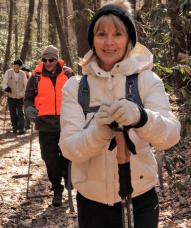
Governed by a 17-member Board of Directors, the primary work of the Benton MacKaye Trail Association today is to maintain and to promote the Benton MacKaye Trail.
For fiscal 2023, the BMTA had over 855 members who share a love for the outdoors as well as the objectives of: preserving, protecting and defending the Benton MacKaye Trail —“… leaving a footpath for generations to follow”.
BMTA volunteers maintain the now 288-mile-long trail in Georgia, Tennessee and North Carolina. In fiscal 2020, volunteers turned in over 6,860.5 hours maintaining the trail!
BMTA sponsors several hikes each month as well as occasional backpacking excursions.
BMTA strives to preserve and protect the amazing natural resource known as the Benton MacKaye Trail.
For “on the job training and education”, the BMTA encourages Scouts as well as college and university students to participate in our twice-monthly work trips. Public education and outreach is offered at events throughout Georgia, Tennessee and North Carolina – including the Annual William T. Hornady Conservation Weekend as well as at various local festivals and venues.
In addition to our newsletter and website, the BMTA is on Facebook and Instagram.
To Join US go to this link: MEMBERSHIP.

Forester and regional planner, Benton MacKaye is best known for his life-long advocacy for the Appalachian Trail (AT) – a trail he first proposed in a 1921 article. Included in that article was the idea for the route that now bears his name, the Benton MacKaye Trail (BMT).
The AT was far from MacKaye’s only contribution to today’s society. For half a century, the tall, lanky New Englander smoking his signature pipe was a familiar sight at environmental and regional planning conferences where he collaborated with some of the movement’s major figures – Bob Marshall and Aldo Leopold.
Throughout his career, MacKaye was employed by several different government agencies – the U.S. Forest Service, the U.S. Geological Survey and the Tennessee Valley Authority, to name a few. Because he found compromise difficult, he frequently wore out his welcome, or resigned in frustration.
Curmudgeon though he may have been, MacKaye was an early and influential promoter of many concepts it would be hard to imagine 21st Century America without, such as:
The BMTA has developed and continues to maintain this trail in cooperation with its two federal agency partners, the U.S. Forest Service and the National Park Service. Following is the list of applicable U.S. Forest Service and National Park Service offices, listed from South to North:
Chattahoochee Oconee National Forests
1755 Cleveland Highway
Gainesville, GA 30501
770-297-3000
www.fs.usda.gov/main/conf/home
Blue Ridge District
2042 Hwy 515 West
Blairsville, GA 30512
706 745-6928
Conasauga District
3941 Highway 76
Chatsworth, GA 30705
706 695-6736
Cherokee National Forest
2800 N. Ocoee Street
Cleveland, TN 37312
423-476-9700
www.fs.usda.gov/main/cherokee/home
Ocoee District
3171 Highway 64
Benton, TN 37370
423-338-3300
Tellico District
250 Ranger Station Road
Tellico Plains, TN 37385
423-253-8400
Nantahala National Forest
160A Zillicoa Street
Asheville, NC 28802
828-257-4200
www.fs.usda.gov/main/nfsnc/home
Tusquitee District
123 Woodland Drive
Murphy, NC 28908
828-837-5152
Cheoah District
1070 Massey Branch Road
Robbinsville, NC 28771
828-479-6431
Great Smoky Mountains National Park
107 Park Headquarters Rd.
Gatlinburg, TN 37738
865-436-1200
www.nps.gov/grsm
The Benton MacKaye Trail Association is grateful for the help and support provided by our 2025 Partners.
Membership fees/donations from our Partners go towards the purchase of tools and materials used to maintain and improve the Benton MacKaye Trail.
For information on our new Partnership program, go to Partners.
Trail clubs, hiking clubs and other organizations also help us to accomplish our mission in a variety of ways – by maintaining a section of the BMT, co-sponsoring a hike, facilitating the distribution of our literature and / or putting on an event where the BMTA can educate the public about the “work we do”.
Other, partner organizations promote the values the BMTA holds dear – they encourage outdoor recreation and public service; promote hiking, camping and a wilderness experience in pristine forests and high, mountain meadows; and, most important, strive to instill a strong conservation ethic.
Briick by Briick Consulting
(678) 409-1242

Robert Crawford
Hixson, TN
Gregory Smith
Gainesville, GA
George Stuart
Chapel Hill, NC
Peter Van Best
Netherlands
BMT Trail Town Communities are a mutually beneficial partnership with the BMT. The trail is an alluring vacation for any outdoor enthusiast. In turn, towns near the trail reap an economic boon from the hikers who spend money for off-the-trail enjoyment or on necessities in the local communities.
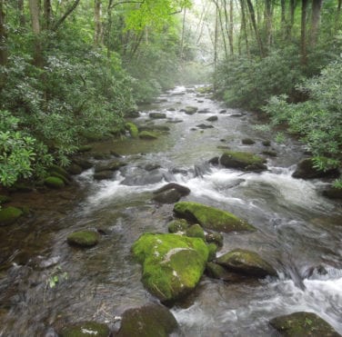
It is no wonder why tens of thousands of hiking enthusiasts from throughout the United States as well as from Europe and Asia are drawn to the 288-mile-long trail. With its glorious ridgeline views and the innumerable crossings of mountain streams, the Benton MacKaye Trail (BMT) comes by its reputation for beauty honestly. Also known for its remoteness, a third of the trail lies in Wilderness areas where vehicular access and motorized tools are prohibited. Here, the hiker finds true peace and solitude.
The Benton MacKaye Trail Town Communities are a key element in making sure the everyday needs of day hikers, backpackers and thru hikers are met. A tasty meal at a nearby restaurant and a good night’s rest at a local lodging facility are a hiker’s delight. To stay properly supplied on the trail, backpackers and thru hikers patronize grocery stores, outfitter stores, pharmacies, laundromat, shuttle services post offices and more.
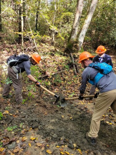
The Benton MacKaye Trail (BMT) would not be the trail it is today had the Benton MacKaye Trail Association (BMTA) not made strong commitments to welcoming everyone interested in the BMT and to building a strong, cohesive volunteer unit based on camaraderie and imparting the pre-requisite skill sets needed for maintaining the trail.
The BMTA extends an open invitation to everyone, from all walks of life, to enjoy the unique wilderness experience found on the BMT. The BMTA invites you to join us!
Join us for a hike! As you follow the woodland pathway, you’ll discover a warm fellowship that encourages friendships and fosters a sense of belonging to a group of people who love the outdoors.
As you become acquainted with our dedicated volunteers and what we do, take the next step to help us maintain the trail. Not an experienced trail worker? On our twice monthly work trips, there is a job for everyone. The only requirement is that you show up. Our volunteers will make sure you have the right equipment and know how to use it before you head for the trail. After work snacks/meals at the trailhead are great for getting to know your fellow workers – and they to getting to know you.
If your skillsets are more in tune with administrative or recruitment activities, there’s plenty of work to do there as well.
Whether on a hike or a work trip, learn what it means to belong to the BMTA as we learn more about you!
To learn more about membership in BMTA, go to Join Us.
Our members, donors and supporters are an integral element of our being able to fulfill our mission – To preserve, protect and maintain the Benton MacKaye Trail (BMT).
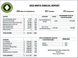
We share the information below so you can feel confident about your investment in the future of the BMT!
As a 501(c)(3) charitable organization, donations are deductible to the degree permitted by law. Our EIN Number is 58-1428009.
Ninety-five per cent of the Benton MacKaye Trail is on either Forest Service or National Park Service property. Benton MacKaye Trail Association (BMTA) needs to move as quickly as possible to secure permanent routes that eliminate the remaining 15 miles or so of road walk and “non-permanent” trail that crosses private land.
BMTA is getting prepared — in 2021, the Board established the Land Acquisition Fund (LAF). But we need your help to fund these endeavors. As of January 18, 2025, the LAF has $90,327!
Tax deductible donations can be made online on the Land Acquisition Fund Donate Page. Or mail a check with the notation “Land Acquisition Fund” in the memo field to: BMTA, PO Box 6, Cherry Log, GA 30522
If you have questions about BMTA’s financial statements or would like more information, please email the BMTA Treasurer – bmtatreasurer@bmta.org.
| President | Bob Cowdrick |
| Vice President | Clare Sullivan |
| Secretary | Jessie Hayden |
| Treasurer | Lydia Burns |
| GA Maintenance Director | Joe Cantwell |
| TN/NC Maintenance Director | Patrick Ward |
| Smokies Coordinator | Steve Pruett |
| Hiking Director | Kelly Motter |
| Store | Sue Ricker |
| Membership Director | Steve Hayden |
| Communications Director | Joy Forehand |
| Conservation Director | Barry Allen |
| Newsletter Editor | Kathy Williams |
| State Rep GA | Darcy Douglas |
| State Rep TN/NC | James Anderson |
| Past President | Ken Cissna |
Benton MacKaye Trail Association
PO Box 6
Cherry Log, GA 30522
Benton MacKaye Trail Association
Privacy Policy
This privacy policy discloses the privacy practices for BMTA.org. This privacy policy applies solely to information collected by this website. This policy identifies the following:
Information Collection, Use, and Sharing
We are the sole owners of the information collected on this site. We only have access to/collect information that you voluntarily give us via email or other direct contact from you. We will not sell or rent this information to anyone.
We will use your information to respond to you regarding the reason you contacted us. We will not share your information with any third party outside of our organization, other than as is necessary to fulfill your request (examples: to submit a donation, to make a reservation for a hike or work trip, to pay membership dues or to purchase items through our Trail Store).
Unless you ask us not to do so, in the future, we may contact you via email to tell you about hikes, work days, program updates and / or changes to this privacy policy.
Your Access to and Control Over Information
You may opt out of any future contacts from us at any time. You can do the following at any time by contacting us via the email at Communications@bmtamail.org:
Security
We take precautions to protect your information. When you submit sensitive information via the website, your information is protected both online and offline.
Wherever we collect sensitive information (such as contact information), that information is encrypted and transmitted to us in a secure way.
While we use encryption to protect sensitive information transmitted online, we also protect your information offline. Only three volunteers who need the information to perform a specific job (for example: updating membership information or processing donations) are granted access to personally identifiable information. The computers / servers on which we store personally identifiable information are kept in a secure environment.
Cookies
We use “cookies” on this site. A cookie is a piece of data stored on a site visitor’s hard drive to help us improve your access to our site and identify repeat visitors to our site. Cookies also can enable us to track and target the interests of our users to enhance the experience on our site. Usage of a cookie is in no way linked to any personally identifiable information on our site.
Links
This website contains links to other sites. Please be aware that we are not responsible for the content or privacy practices of such other sites. We encourage our users to be vigilant when they leave our site and to read the privacy statements of any other site that collects personally identifiable information.
Updates
Our Privacy Policy may change from time to time and all updates will be posted on this page.
If you feel that we are not abiding by this privacy policy, you should contact us immediately via email at Communications@bmtamail.org.