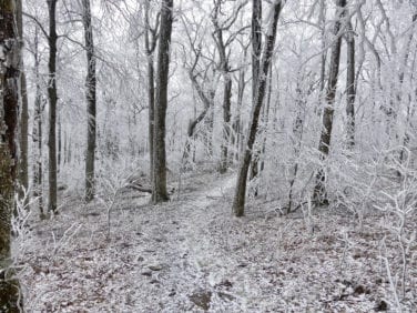
Loops Near Springer Mountain
Loops Near Springer Mountain – 4.6, 6.2 and 10.6 miles
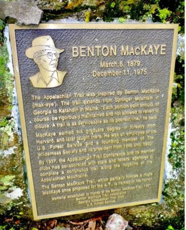
There are several loops of varying distances formed by the Benton MacKaye Trail and Appalachian Trail in the first few miles north of the southern terminus of each trail at Springer Mountain, GA. They are suitable for day hikes of moderate difficulty.
- From Springer Gap parking lot on FS 42 south on Appalachian Trail to Springer Mountain, north on Benton MacKaye Trail to Big Stamp Gap to first Benton MacKaye Trail/Appalachian Trail Intersection and back south on Appalachian Trail to parking lot.
- From Springer Gap parking lot north on Appalachian Trail to Benton MacKaye Trail intersection, north on Benton MacKaye Trail to the third intersection with the Appalachian Trail, north on the Benton MacKaye Trail / Appalachian Trail to Three Forks and south on the Appalachian Trail to the parking lot. By doing the loop this way, you reach the Stover Creek Shelter on the Appalachian Trail after 4.6 miles at a good place for lunch or a break before the moderate climb back to the parking lot.
- From Springer Gap parking lot south on Appalachian Trail to Springer Mountain, north on Benton MacKaye Trail to Three Forks and south on Appalachian Trail to parking lot.
Check for the latest trail conditions HERE.
Loops Near Springer Mountain Trail Information
Trailheads are at the Springer Gap parking lot on FS 42 and Three Forks on FS 58.
- Distance: 4.6, 6.2 and 10.6 miles
- Difficulty Rating: Intermediate / Difficult.
- Benton MacKaye Trail Section #: 1a, 1b and 1c.
- Dog Friendly? Dogs on Leash Allowed.
- Recommended Guide Book: Benton MacKaye Trail Guide – GA Section
See onX Hiking Project for map and further details:
Three Forks to Skeenah Gap
A Two-Night Backpacking Hike
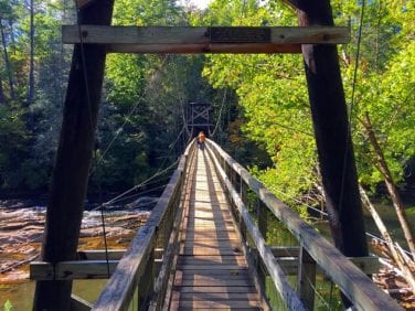
This is not a hike for beginners, but it is a fantastic hike for middle of the road backpackers looking for a serious challenge. This hike begins with a gorgeous waterfall one mile into the hike, a 260′ suspension bridge at mile nine, beautiful ridge line views all along Toonowee Mountain and year round views on the approach to Wallalah at mile 14. It also answers several questions for the weekender: Am I ready for more grueling distance hikes? Do I have the right gear? Is pack weight a problem?
These 18 miles will really test you! (Experienced ‘packers looking to stay in shape can add another 5.2 miles, ending at Wilscot Gap.)
Plan to arrive at Three Forks with a bit of daylight left on the first day. Since the Appalachian Trail and the Benton MacKaye share the first mile before splitting at Long Creek Falls, the goal is to hike beyond the falls, leaving the crowds behind. The next 17 miles are sparsely hiked and easy to enjoy. Give some thought to planning based on your abilities. There are several areas to camp with good water in the first 12 miles. The final six miles to Skeenah Gap are hard miles, with limited water – with about four miles to go, lunch on your final day at the Wallalah Overlook is a backpacker’s delight.
Enjoy!
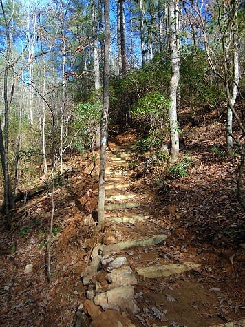
The trail signs, steps and bridges along this section of trail are provided by generous donors. Make a donation today to help keep the trail in great shape.
Three Forks to Skeenah Gap Trail Information
- Distance: 18.4 miles.
- Difficulty Rating: Difficult.
- Benton MacKaye Trail Section #: 2c. 2d, 3a, 3b and 3c.
- Dog Friendly? Dogs on leash allowed, but not advisable – water is very limited on final half of hike.
- Recommended Guide Book: Benton MacKaye Trail Guide – GA.
See onX: Hiking Project for map and further details:
- 2a-2b Three Forks FS58 to Bryson Gap
- 2c-2d-Bryson-Gap to GA HWY 60
- 3a-3c-GA HWY 60 to Skeenah Gap
- 4a-4b Skeenah Gap to Wilscot Gap HWY 60
Check for latest trail conditions HERE.
Georgia Loop
Georgia Loop – 55 miles
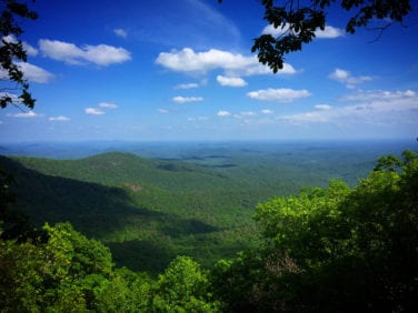
This loop is the triangle formed by the Benton MacKaye Trail, Duncan Ridge Trail and the Appalachian Trail. It is described as “the toughest hike in Georgia.” Trailheads include Three Forks on FS 58, Skeenah Creek on GA 60 and Woody Gap on GA 60.
Georgia Loop Trail Information
- Distance: 55 miles.
- Difficulty Rating: Intermediate / Difficult.
- Benton MacKaye Trail Section #: 2a, 2b, 2c, 2d, 3a, 3b and 3c.
- Dog Friendly? Dogs on Leash Allowed.
- Recommended Guide Book: Benton MacKaye Trail Guide – GA Section.
See onX: Hiking Project for map and further details:
See Erik Jarvi’s description of the Georgia Loop.
Bushy Head Gap to Watson Gap
A One-Night Backpacking Hike
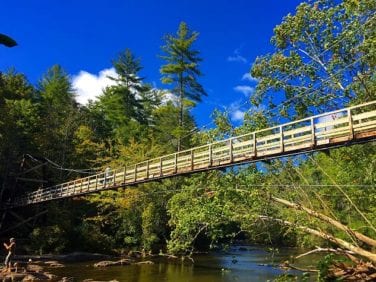
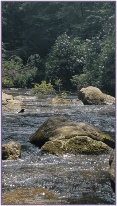
This is a great hike for beginners and intermediate level backpackers – but it’s not especially challenging for experienced hikers. The most important thing to keep in mind is to be ‘Bear Aware’. Wildlife is abundant, and it is not unusual to see black bear, turkey, deer AND timber rattlers along these sections of the trail. The South Fork of the Jacks is host to a good population of trout. So, for hikers who may also double as fly-fishermen, pack a 7 ½-foot, three- or four-wt rod with a small assortment of nymphs and terrestrials. Casting can be challenging along the Jacks, as rhododendron grow thick along its banks.
Hikers of all levels will enjoy the remoteness of the hike. Due to the limited access points on Section 8, it is not unusual to go all day and see no other hikers. We like to plan this hike so the second night is spent in camp along the South Fork of the Jacks. There are a couple of absolutely gorgeous campsites on the South Fork and this leaves a short hike for the third day out to Watson Gap — especially nice for those who plan to fish a bit or spend some time in the water with younger hikers.
As you hike this trail, consider the challenge volunteer trail crew members face as they work to keep it clear and in good shape for hikers. Consider giving back and joining the Georgia Trail Crew. They meet and hit the trail the second Saturday of each month. Check out the Calendar of Events to find out all the details on how you can join them.
Bushy Head Gap to Watson Gap Trail Information
- Distance: Approximately 17.5 miles.
- Difficulty Rating: Intermediate.
- Benton MacKaye Trail Section #: 8a – 9c.
- Dog Friendly? Dogs on Leash Allowed.
- Recommended Guide Book: Benton MacKaye Trail Guide – GA.
See onX: Hiking Project for map and further details:
8a-8d Brushy Head Gap to Fowler Mountain
8e-8h Fowler Mountain to Dyer Gap
9a-10a Dyer Gap to Jacks River Trail Dally Gap
Check for the latest trail conditions HERE.
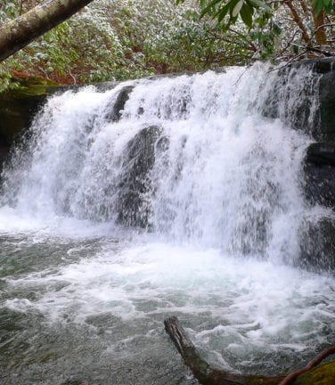
Upper Bald River Wilderness Loop
Upper Bald River Wilderness Loop
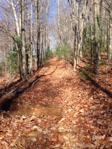
Begin at Campsite 11 (near the start of Brookshire Creek Trail) along Bald River Road. After hiking for about two miles up along the Bald River on the Brookshire Creek Trail, you’ll turn right at the BMT signpost uphill along Brookshire Creek to Sled Runner Gap, about four miles further up the trail. There are several crossings of Brookshire Creek and the Bald River which, depending on water levels, might require water shoes.
Just before the Bald River / Brookshire Creek intersection is a nice waterfall on the Bald River locally known as Upper Bald River Falls. Just past the intersection is a crossing of Brookshire Creek just before it joins the Bald River with a small eight-foot waterfall. The pull up the Brookshire Creek Trail to Sled Runner Gap along the BMT is a long uphill haul, but there is a nice campsite about two thirds of the way up right along Brookshire Creek.
When you reach Sled Runner Gap, the trail to the left will take you to Beaverdam Bald after about a half mile. The trail to the right is the BMT and crosses over several peaks in a generally downward direction to Sandy Gap after about 6.3 miles. From here, I recommend the backpacker continue on the BMT straight ahead to Six Mile Gap, then right to Waucheese Bald (total distance about 2.5 miles) to a great place to camp on a big open grassy bald. Water is available about a half mile down the road where the road takes a sharp left or you can bring water up from the spring near Sandy Gap a short ways down the Kirkland Creek Trail.
The next morning, return from Waucheesi Bald to Sandy Gap, then take the Kirkland Creek Trail downhill for 4.5 miles to several crossings of the creek — then a crossing over the Bald River, all without bridges. Just past the Bald River crossing, you’ll reach Bald River Road. Turn right and go a short distance back to your car.
This is a challenging section of trail to maintain for the volunteers with the Benton MacKaye Trail Association Tennessee trail crew. They are always looking for a few good trail warriors to work this section. The Tennessee Trail Crew regularly goes out the fourth Saturday of each month. Go to the Calendar of Events to find all the details and plan to join the crew.
Upper Bald River Wilderness Loop Trail Information
- Distance: Hiker’s choice.
- Difficulty Rating: Intermediate / Difficult.
- Benton MacKaye Trail Section #: 15c, 16a, 16b and 16c
- Dog Friendly? Dogs on Leash Allowed.
- Recommended Guide Book: Benton MacKaye Trail Guide – TN/NC.
See onX: Hiking Project for map and additional details:
- Upper Bald River Wilderness Loop
- 15a-15c – Unicoi Gap to Sandy Gap
- 16a-16b Sandy Gap to Sled Runner Gap
- 16c-16d – Sled Runner Gap to Tellico River
Check for latest trail conditions HERE.
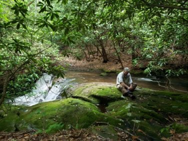
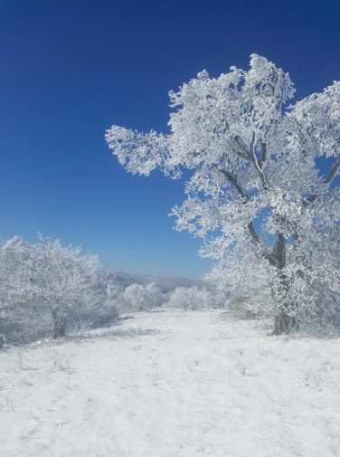
Hike to Bob Bald with The Hangover
A One- or Two-Day Backpacking Hike in Tennessee and North Carolina
Miles from traffic noise, a high elevation open meadow with a clear view of the eastern horizon offers you the opportunity to experience one of the most unique topographic features found only in a very few places in east Tennessee.
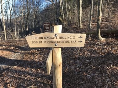
Your “in and out” hike begins at Beech Gap on the Cherohala Highway at the Tennessee / North Carolina state line. At Cold Springs Gap, take Trail 54A on the right, the Bob Bald Connector to Bob Stratton Bald and beyond to The Hangover.
This is a moderately easy hike except for the brief, but steep, hike from Cold Springs Gap to Bob Stratton Bald – a special backpacking spot where sunrises, moon rises and dark sky viewing will keep you coming back.
Make it a two “nighter” and spend day two on the moderately difficult round-trip hike to The Hangover, a 5160-foot pinnacle with 360 degree views, including a dramatic, one of a kind look at the southern end of the GSMNP. The Hangover is rivaled only by the Smokies’ Mount Cammerer fire tower lookout, noted for its high, unobstructed panoramic views.
This family friendly backpacking adventure is highly recommended for first time backpackers — to see if they really like backpacking. Of the upmost importance … everyone should be old enough to carry their own pack!
As you hike this amazing section of trail, you will quickly come to realize the challenges of distance and access our volunteers face as they seek to keep the trail open and in good shape for your hike. You are invited to help us. Learn more here.
Hike to Bob Bald with The Hangover Trail Information
- Distance: 13 miles round trip to The Hangover or 3.5 miles one way to Bob Bald.
- Difficulty Rating: Intermediate to Difficult.
- Benton MacKaye Trail Section #: 18a.
- Dog Friendly? Dogs on Leash Allowed.
- Recommended Guide Book: Benton MacKaye Trail Guide – TN/NC Section.
See onX: Hiking Project for map and additional details: Hike to Bob Bald with The Hangover Added.
Check for the latest trail conditions HERE.
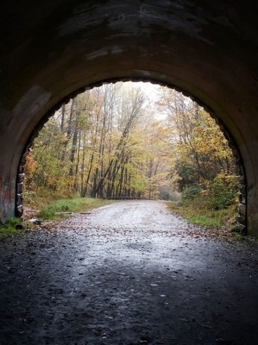
Tunnel to Nowhere –
Smokemont … or to Fontana Dam
A Two-Night Backpacking Hike
Check for the latest trail conditions HERE.
Travel six miles on a scenic mountain highway to arrive at one of the most unique trailheads ever … the “Tunnel to Nowhere” / the “Road to Nowhere”. The quarter-mile long tunnel was to be part of a relocated route to Deals Gap for residents of Swain County displaced by the then new Fontana Lake. Environmental issues prevented the rest of the route from being completed.
Backpackers can choose from two backpacking hikes from the tunnel. One is 26.8 miles northbound on the BMT to Smokemont. The other is 34.7 miles southbound on the BMT to Fontana Dam.
Before embarking on either hike, a visit to the tunnel is a must. You’ll want to proceed cautiously as you take your first steps into the tunnel’s entrance. Your initial hesitancy quickly is overcome by the appeal of the sunlit forest beyond the darkness. Once at the far end of the tunnel, to continue your hike to Smokemont, turn around and head north on the BMT. Features along this section of the BMT include a huge boulder field, fragrant pine forest and the now deserted community of Solola Valley.
A great place to camp for the first night is Campsite #61, between the Nolan Divide and the junction of Bull Creek. The sound of rushing water between the two creeks makes for a restful night’s sleep.
In the spring, day two will be a gorgeous wildflower / Rosebay Rhododendron-lined hike along the joint BMT/in-development North Carolina Mountains to Sea Trail.
With 360-degree views of the Smokies (including Clingmans Dome, Mount LeConte and Charlies Bunion), Newton Bald is the perfect spot to camp for the final night of your journey.
The last leg of your trek is an easy one — all downhill with a spectacular array of wildflowers in the spring — harebells, vasey’s trillium, jack in the pulpit, foam flower, hepatica, crested dwarf iris, showy orchis and the rarely seen umbrella plants.
Your journey ends at the site of a once thriving lumber community — now the Smokemont Campground.
If after traversing the tunnel, you chose to continue south on the BMT … As you enter the Tunnel at the end of the Road To Nowhere, you are starting one of the longest sections of trail between two vehicle accessible trailheads in the country, 33.5 miles. Keep in mind how remote this area still is today. Realize that before Fontana Dam was built, more than 5,000 people made lived in the area through which you will be walking. Stay alert for lingering vestiges of their existence, like the stone walls, frequently hidden under the leaves, that were the foundations of buildings. Watch for obvious, but unmarked, trails with just a “Horses Prohibited” sign that lead to one of the many cemeteries in the area. Take time for a side trip to visit some of these. Realize that most of the campsites along the “Lakeshore Trail” are at the locations of homesteads from long ago. You are hiking through history.
Become a Member of the Benton MacKaye Trail Association – details HERE.
Tunnel to Nowhere –
Smokemont … or to Fontana Dam Trail Information
- Distance: 26.5.
- Difficulty Rating: Easy / Intermediate.
- Benton MacKaye Trail Section #: Section 20a, 21a-b-c 22a-b, 22c-23a, 23b and 23c.
- Dog Friendly? Dogs Not Allowed in the Great Smoky Mountains National Park.
- Recommended Guide Book: Benton MacKaye Trail Guide – Smokies.
See onX: Hiking Project for map and further details:
22c – Lower Noland Creek Trail
Southern Loop: Springer Mountain to
Fontana Dam
Southern Loop: Springer Mountain to Fontana Dam – 367 miles
This is the southern loop of the big figure eight formed by the Benton MacKaye Trail and Appalachian Trail. The Benton MacKaye Trail / Appalachian Trail intersection at Sassafras Gap is shortly after each trail enters the Great Smoky Mountains National Park. There are numerous trailheads on either the Benton MacKaye Trail or Appalachian Trail on this loop.
Southern Loop: Springer Mountain to Fontana Dam
Fontana Dam Trail Information
- Distance: 367 miles.
- Difficulty Rating: Intermediate / Difficult.
- Benton MacKaye Trail Section #: 1 thru 19.
- Dog Friendly? Dogs not allowed in GSMNP.
- Recommended Guide Book: Benton MacKaye Trail Guide – GA Section, Benton MacKaye Trail Guide – TN/NC Section, Benton MacKaye Trail Guide – Smokies
See onX: Hiking Project for map and further details:
Hiking Project – Benton MacKaye Trail Once on this page, scroll down to “Hike Sections” & select the section you want to research.
Northern Loop: Fontana Dam to Big Creek
Northern Loop: Fontana Dam to Big Creek – 154 miles
This is the northern loop of the big figure eight formed by the Benton MacKaye Trail and the Appalachian Trail. It is entirely within the Great Smoky Mountains National Park. Access on the Appalachian Trail is from Fontana Dam, Newfound Gap and Big Creek. Trailheads on the Benton MacKaye Trail are at the Twentymile Ranger Station, Noland Creek, Smokemont, Round Bottom and the Big Creek Ranger Station.
Northern Loop: Fontana Dam to
Big Creek Trail Information
- Distance: 154 miles.
- Difficulty Rating: Intermediate / Difficult.
- Benton MacKaye Trail Section #: 20 & 23.
- Dog Friendly? Dogs not allowed in GSMNP.
- Recommended Guide Book: Benton MacKaye Trail Guide – Smokies
See onX: Hiking Project for map and further details:
- 20 Fontana Dam to Camp 90
- 22c 23a Upper Noland Creek Trail
- 23b Mountains to Sea Trail
- 23c Newton Bald to US441 at Smokemont
Note: this multi-trail loop hike is entirely in the Great Smoky Mountains National Park and requires a back-country permit. Go to Backcountry Camping – Backpacking – Permits Required
Figure Eight:
Springer Mountain to Big Creek
Figure Eight: Springer Mountain to Big Creek – 521 miles
This lopsided figure eight is formed by the Benton MacKaye Trail and Appalachian Trail between their southern terminus at Springer Mountain and the northern terminus of the Benton MacKaye Trail at Big Creek, where the Appalachian Trail leaves the Smokies. Between these points, the Benton MacKaye Trail covers 287 miles while the Appalachian Trail covers 234 miles.
Figure Eight: Springer Mountain to
Big Creek Trail Information
- Distance: 521 miles
- Difficulty Rating: Intermediate / Difficult.
- Benton MacKaye Trail Section #: 1a through 25b.
- Dog Friendly? Dogs on Leash Allowed / Dogs not allowed in GSMNP.
- BMT/AT Loop Map
- Recommended Guide Book: Benton MacKaye Trail Guide – GA Section, Benton MacKaye Trail Guide – TN/NC Section, Benton MacKaye Trail Guide – Smokies
Hiking Project – Benton MacKaye Trail Once on this page, scroll down to “Hike Sections” & select the section you want to research.
1,000 Mile Challenge
Appalachian Trail (Springer >> Big Creek) – Benton MacKaye Trail – Pinhoti Trail
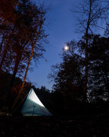
The Benton MacKaye Trail Association (BMTA), the Alabama Pinhoti Trail Association (APTA) and the Georgia Pinhoti Trail Association (GPTA) have joined together to offer the 1,000 Mile Challenge. The Challenge was created to showcase the beauty of the Southern Appalachian Mountains in Alabama, Georgia, Tennessee and North Carolina. The 13 Wilderness Areas through which the Challenge passes offer the hiker a unique, peaceful solitude not found in other forest settings.
The route for the Challenge includes:
- The Appalachian Trail (AT) (Davenport Gap >> Springer Mountain)
(The Chestnut Branch Trail (Big Creek >> Davenport Gap) is used to connect the AT and BMT.) - The BMT (Springer Mountain >> Big Creek
- The Pinhoti National Recreation Trail (PNRT) (Flagg Mountain >> the intersection with the Benton MacKaye Trail (BMT near Dyer Gap)
The approximately 1,000-mile route forms a lollipop – hikers may begin/end at any point on the route. The associations will recognize both thru and section hikes.
To receive a Certificate of Completion and/or a 1,000-Miler rocker, go to 1,000-Mile Challenge.
1,000 Mile Challenge Information
- Distance: 1,000 miles
- Difficulty Rating: Intermediate / Difficult.
- Benton MacKaye Trail Section #: 1a through 25b.
- Dog Friendly? Dogs on Leash Allowed / Dogs not allowed in GSMNP.
- 1,000-Mile Challenge Map
- Recommended Guide Book: Benton MacKaye Trail Guide – GA Section, Benton MacKaye Trail Guide – TN/NC Section, Benton MacKaye Trail Guide – Smokies
Hiking Project – Benton MacKaye Trail Once on this page, scroll down to “Hike Sections” & select the section you want to research.
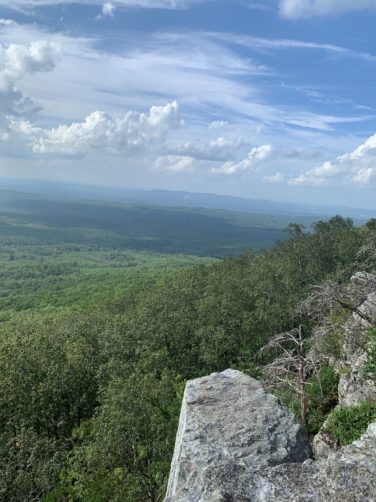
Picture on right is of Wormy Pulpit on the Pinhoti Trail.
Other Long Distance Trails
Other Long-Distance Trails Intersecting the Benton MacKaye Trail
Although not forming loops with the Benton MacKaye Trail, the following long-distance trails also intersect the Benton MacKaye Trail and can be combined with it:
Pinhoti Trail in Section 9 and
Mountains-to-Sea Trail in Section 21.
Go to Facebook – Benton MacKaye Trail Hikers, ask to join and then post your pictures and stories here.
