Skip to Main Content

Weekend Hikes with the Family

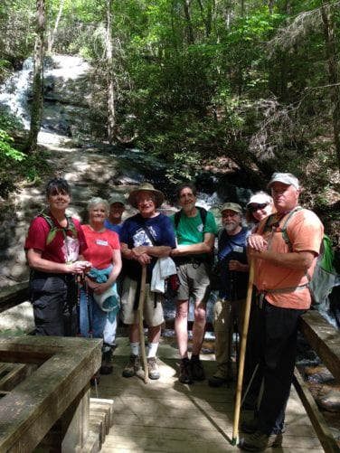
Long Creek Falls

Long Creek Falls

A popular destination for day hikers, this is an awesome choice for a fairly easy, kid friendly two-mile day hike! Meandering creeks as well as abundant flora and fauna also have made this area a favorite with backpackers, fishermen and campers.

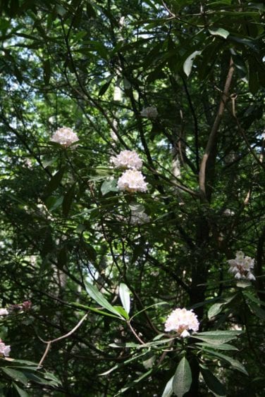
Initially you’ll stroll through a corridor of dead and dying Hemlock trees which gives way to bouquets of New York ferns, violets and pungent Galax.  As the elevation increases, you’ll notice more hardwoods and then travel thru Rhododendron thickets as you descend to the falls.

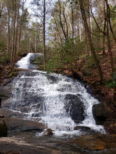
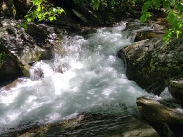
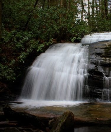
For most of the way you’ll be serenaded by Long Creek as it bubbles over and around the rocks, finally giving way to the roar of the falls as voluminous cascades of water pour down the 50-foot high sheer rock cliff. Numerous stands of emerald green Rhododendrons provide a stunning contrast to the white water rushing down the rock wall.

When you arrive at the intersection where the AT and BMT take their separate routes to the north, you’ll see the side trail to the falls.

Be sure to bring a picnic lunch – just 100 yards up the side trail to the left, is the perfect spot for a picnic!

If a longer hike is desired, you can continue another 7.8 miles on the Benton MacKaye Trail to the famous Toccoa River suspension bridge over the Toccoa River. The bridge spans 260 feet and is the longest suspension bridge east of the Mississippi. The banks surrounding the bridge are the ideal place for a picnic lunch.

The parking area for your shuttle is about a quarter mile beyond the bridge.

Before you set out on the trail consider becoming a member of the Benton MacKaye Trail Association and support the efforts that make your hike possible. Become a Member

Long Creek Falls Trail Information

Check for the latest trail conditions HERE

For a day hike:

  • Distance: 2 miles.
  • Difficulty Rating: Easy.
  • Benton MacKaye Trail Section #: Section 2a and 2b.
  • Dog Friendly? Dogs on Leash Allowed.

Recommended Guide Book: Benton MacKaye Trail Guide – GA Section.

See onX: Hiking Project for map and additional details:  Long Creek Falls Hike.


For a longer hike:

  • Distance: 8.8 miles – Shuttle required.
  • Difficulty Rating: Easy / Intermediate.
  • Benton MacKaye Trail Section #: Section 2a, 2b and 2c.
  • Dog Friendly? Dogs on Leash Allowed.

Recommended Guide Book: Benton MacKaye Trail Guide – GA Section.

See onX: Hiking Project for map and further details: Long Creek Falls Hike – BMT 2a-2b  and Hike to Suspension Bridge.

rhododendron at long creek falls
Swinging Bridge

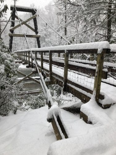
Toccoa River Bridge (Swinging Bridge)

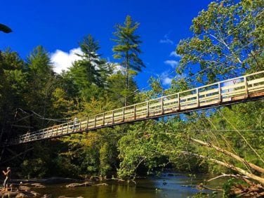
One of the most visited sites on the Benton MacKaye Trail (BMT) is the 260-foot “Swinging Bridge” across the Toccoa River, near Blue Ridge and Ellijay, GA.

Frequent hikers will enjoy the 3.5-mile hike on the BMT from GA Hwy 60 between Morganton and Suches, but for kids, you’ll want to consider the three-mile drive on the unpaved Forest Service Road 816. From the parking area, it’s a short walk to the bridge.

Built in the mid-1970s, it is one of the longest foot trail suspension bridges in the East and the longest in the southern Appalachians — only forty feet short of a football field’s length. Originally built as a relocated Appalachian Trail route, in the early 1980s, the Swinging Bridge became part of the route for the BMT.

The bridge spans pristine, picturesque rapids on the Toccoa River — which is part of the officially designated “Toccoa River Canoe Trail” (14 miles long) within the Chattahoochee National Forest. Here you are likely to see fisherman and canoeists as well as other hikers enjoying the beautiful Toccoa River.

And, kids will especially enjoy their walk across the bridge as it bounces a bit with each step.

Be sure to bring a picnic lunch to enjoy stream-side!

The Benton MacKaye Trail Association helps maintain the bridge by replacing timbers and hardware. The work is funded by donations. Learn how you can make a donation to one of the many trail projects by going to DONATE.

Toccoa River Bridge Trail Information

  • Distance: seven-miles round trip on the Benton MacKaye Trail or walk from the parking lot off Forest Service Road 816.
  • Benton MacKaye Trail Section #: 2c and 2d.
  • Difficulty Rating: Intermediate.
  • Dog Friendly? Dogs on Leash Allowed.
  • Recommended Guide Book: Benton MacKaye Trail Guide – GA Section.

See onX: Hiking Project for map and additional details:

Bryson Gap to GA Hwy 60

Toccoa River Suspension Bridge

Check for the latest trail conditions HERE

Swinging Bridge Richard Parks photo
Fall Branch Falls

Fall Branch Falls

A must do hike for the entire family! Emerald green Mountain Laurel and Rhododendron line the half-mile moderately easy trail to the falls. An extremely popular trek for tourists and locals alike, resting benches have been strategically placed along the trail.

As you descend to the viewing platform at the bottom of the falls, you’ll begin to see glistening cascades of white water surging down the 100-foot rock cliff.

If a longer hike is desired, continue beyond the falls northward on the Benton MacKaye Trail towards Rocky Mountain. You are in for a hearty climb and then a long downhill over Scroggin Knob to BMT’s Weaver Creek Road parking area – the hike is 6.2 miles (one way).

In the spring, Catesby’s Trillium, Grandiflora Trillium Wakerobin, May Apples as well as lush Cinnamon ferns litter the landscape along the approach to Rocky Mountain.

Be sure to take the side trail (adjacent to the Rocky Mountain sign) to the top of the mountain. It’s the perfect picnic spot and, when the trees are bare, the views from here are fabulous!

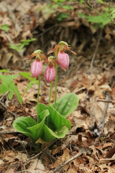
As you continue your journey on the BMT, you’ll pass several gardens of the delicate Pink Lady Slipper orchids, groves of Mountain Laurel and Rhododendron as well as vibrant Flame Azaleas. Rock cairns mark the remains of an old homestead site.

Resting benches, steps and the viewing platform were constructed by members of the Benton MacKaye Trail Association. Learn more about Donating to this and other trail projects.

Map of both falls locations and road access are available at the Fannin County Welcome Center, open seven days / week in Blue Ridge.

Fall Branch Falls Trail Information

  • Distance: 0.5 miles, or for the longer hike to Weaver Creek Road, 6.2 miles (both mileages are one way).
  • Difficulty Rating: Easy / Intermediate.
  • Benton MacKaye Trail Section # 6 — if you continue for the longer hike, 6c and 6d.
  • Dog Friendly? Dogs on Leash Allowed.
  • Recommended Guide Book: Benton MacKaye Trail Guide – GA. 

See onX: Hiking Project for map and additional details:

Fall Branch Falls

6b-6d Stanley Creek Road to Weaver Creek Road

Check for the latest trail conditions HERE.

people on fall branch falls trail
lady slipper hike

Lady Slippers and Wildflowers

Waterfalls and Spring Flowers Highlight This Hike

A spectacular waterfall, mountaintop vistas and a wide array of springtime wildflower are on the agenda for this hike.

You begin with a moderately easy assent on a narrow forest path. At a half mile, you’ll descend to the viewing platform at the bottom of the rushing water of Fall Branch Falls. The trek continues with a fairly steep assent / then gradual uphill on a wildflower-lined pathway to Rocky Mountain – the perfect place to take a break to enjoy a leisurely lunch surrounded by vibrant wildflowers and far off mountain views.

This beautiful section of trail is maintained by volunteers with the Benton MacKaye Trail Association, please Join and learn how you can Volunteer.

In the spring, the next stop on your itinerary is one of the best Pink Slipper Orchid gardens on this section. The delicate pink beauties line the BMT as you approach the intersection with the water cutoff to a nearby spring. The trail continues down an old roadbed to an old homestead site and then ascends again to Scroggin Knob. Your route is peppered with lots of small Lady Slipper gardens as well as Mountain Laurel and a few Flame Azaleas.

After a fairly steep descent down Scroggin Knob, your itinerary concludes on a forest pathway that winds through graceful Mountain Laurel, Flame Azalea and Rhododendron on the way to the Weaver Creek trailhead.

Lady Slippers and Wildflowers Trail Information

  • Distance: 6.2 miles.
  • Difficulty Rating: Intermediate / Difficult.
  • Benton MacKaye Trail Section # 6b, 6c and 6d.
  • Dog Friendly? Dogs on Leash Allowed.
  • Recommended Guide Book: Benton MacKaye Trail Guide – GA.  
  • See onX: Hiking Project for map and additional details:

Fall Branch Falls

6b-6d Stanley Creek Road to Weaver Creek Road

Check for the latest trail conditions HERE.

Lady Slipper
Lost Creek

Lost Creek

Lost Creek Limestone Gorge Hike, Reliance, TN

This is a great kid and dog friendly hike near Reliance, TN. Imagine your kids and dogs playing below gentle waterfalls in a limestone gorge with the trail right next to the creek.

Because it follows an old roadbed most of the way, the trail is easy hiking … and … some say this hike is one of the most beautiful hikes on the Benton MacKaye Trail.

Be sure to bring swim trunks and towels! This section is loaded with smallmouth bass, so bring your fishing pole as well.

The trail leaves the road to switchback down to the creek where you follow the trail downstream. The best part of the gorge with the waterfalls is about a mile downstream … a great place to hang out.

Be sure to take your camera to capture your memories. And, take a lunch for your family crew.

With kids, we advise driving to Lost Creek Campground. Hike down the creek for three miles. Where the trail leaves the creek, turn around and hike back making for a six-mile hike. Here you also have the option of hiking down the creek as much or as little as the kids want. Enjoy a swim and hike back to Lost Creek Campground.

You will be interested to know that this trail is maintained by a “Section Maintainer”. He lives in Madisonville, TN, and spends many a Saturday removing down trees and clearing the overgrowth. Interested in Trail Maintenance? Learn More

Lost Creek Trail Information

See onX: Hiking Project for map for additional details: Lost Creek Limestone Gorge Hike.

Check for the latest trail conditions HERE

lost creek waterfalls
Hiwassee

Hiwassee River

Hiking along the Hiwassee River, Reliance, TN

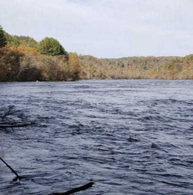
The Hiwassee River is one of the most gorgeous rivers in the Appalachians. It is a broad, raging river with continuous shoals.

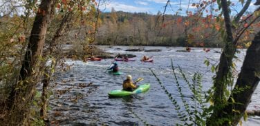
When the water is low, trout fishermen wade the river with their fly rods, and when the river is up, they’re seen in their weird-shaped drift boats. When high, the river is home to hundreds of kayaks and canoes.

Start your hike at the Childers Creek Trailhead and head upstream to the Towee Creek parking area. The first three miles takes you along the edge of the river and around a rocky point at the half-way point– which makes a great picnic spot. Farther upstream, there is a campsite with an inviting swimming beach when the water is low. The last 1.3 miles takes you up on the side of the ridge with great views of the river valley below.

This hike is best done with a shuttle, but you can hike up and back for a nice 8.6-mile hike, or, six miles if you turn around at the Big Bend parking area.

A super fun hike for kids – afterwards, stop for burgers and refreshments at Flip Flop Burgers by the TN-315 bridge.

This section of trail is maintained by our partner, the Cherokee Hiking Club. To learn how your group, church or business can adopt a section of trail contact us.

Hiwassee River Trail Information

  • Distance: 4.3-miles one way.
  • Difficulty Rating: Easy.
  • Benton MacKaye Trail Section #: 13b and 13c.
  • Dog Friendly? Dogs on Leash Allowed.
  • Recommended Guide Book: Benton MacKaye Trail Guide – TN/NC.

See onX: Hiking Project for map and additional details:  Hiking along the Hiwassee River.

Check for the latest trail conditions HERE.

Hiwassee
Whigg

Whigg Meadow

Whigg Meadow, Tellico Plains, TN, and Robbinsville, NC

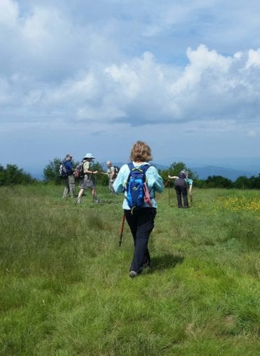
How would you like to take your family and dog up to a wide open bald on the top of the world? At Whigg Meadow, you’ll find great views and feel cool breezes. Enjoy your lunch sitting in the grass while your kids eat blueberries and blackberries and your dog romps around investigating every enticing scent.

Whigg Meadow is a “must do” on your hike list — it’s only a moderate 1.6 mile hike to get there!

The trailhead is at Mud Gap at mile 3.5 on the North Carolina side of the Cherohala Skyway. Hike up 500 feet in elevation over 1.6 miles to The Whigg, as locals call it. The bald is 5000 feet above sea level and 4300 feet above Tellico Plains and the Tennessee River.

This section of trail is maintained by a couple from Maryville, TN. To learn how your family can be involved in maintaining and preserving the trail go to Volunteer.

From the top you can see Big Frog Mountain, the Cumberland Plateau, Waucheesi Bald, Flats Mountain, the Cherohala Skyway and Haw Knob (at 5476 feet, this is the highest point in Monroe County, TN).

After your adventure, head back the way you came. Whether heading west on the Cherohala Skyway to Tellico Plains, or travelling east to Robbinsville, you’ll be captivated by the lovely views along this scenic byway.

End your day with supper in Tellico Plains or Robbinsville – what a great way to spend the day with your family!

Whigg Meadow Trail information

See onX: Hiking Project for map and further details:  Whigg Meadow Hike.

Check for the latest trail conditions HERE

Whigg
Bear Pen Hike

Yellow Creek to Tapoco Lodge

Old Field Gap Road to Tapoco Lodge Hike 

After enjoying an amazing pizza at Tapoco Lodge, go west to the Burchfield Trailhead, Meadowspring Branch Road just off Route 129 across from Tapoco Lodge. Proceed uphill to Old Field Gap Road and turn right. The trailhead will be on your right.

It is best walked East to West (from Old Field Gap Road). Your trek is mainly downhill, but is a bit steep at the very end. The final hill can be a bit treacherous in the fall when an abundance of acorns on the trail become “slip and slide” marbles under your feet – two trekking poles advised!

Should you desire more of a challenge, proceed uphill at the Burchfield Trailhead on Meadowspring Branch Road, just off Route 129. Continue uphill to Old Field Gap Road.

This section, one of the nicest along the entire Benton MacKaye Trail, offers good tread and some outstanding views of the Hangover Lead (Ridge) to the west and views all the way to northern Georgia. This section originally was part of the AT until 1947 — sharp-eyed hikers can spot some of the original chopped blazes in the large trees as well as old red and blue blazes painted in olden times. The section was reopened in 2014 as part of BMTA’s Yellow Creek Reroute Project. One dry campsite is near the top.

Tapoco Lodge is a Business / Corporate Member of the Benton MacKaye Trail Association. To learn how your business can support the trail, go to MEMBERSHIP. Benton MacKaye Trail Association members appreciate and support the businesses that support the trail.

Yellow Creek to Tapoco Lodge Trail Information

  • Distance: 1.9 miles one way from Tapoco Lodge.
  • Difficulty Rating: Easy (From Old Field Gap Road).
  • Intermediate / Difficult (If Starting from the Burchfield Trailhead.)
  • Benton MacKaye Trail Section #: 19A.
  • Dog Friendly? Dogs on Leash Allowed.
  • Recommended Guide Book: Benton MacKaye Trail Guide – TN/NC Section.

See onX: Hiking Project for map and additional details: Old Field Gap Road to Tapoco Lodge.

Check for the latest trail conditions HERE.

Bear Pen Gap
lookout rock view

Yellow Creek Ridge

Yellow Creek Ridge Hike

This section, part of Benton MacKaye Trail Association’s Yellow Creek Reroute Project in 2014, follows the Yellow Creek Ridge just south of the Little Tennessee drainage. You’ll enjoy great views both north into the Great Smoky Mountains National Park and south to Georgia.

In part, this follows Forest Service roads replanted as wildlife feed plots, so high brush is typical during the summer. Originally part of the AT until 1947, and site of one of the cabins of the infamous Kirkland Bushwhackers at Kirkland Gap (no remains), this section passes under the high-power lines from the Rymer’s Ferry Power Station. There is no water along the trail until you approach Fontana.

At Fontana Lodge, thru hikers can obtain camping permits for the National Park.

This section of trail and several others in North Carolina are maintained by Graham County Friends. They are eager to welcome new volunteers. For additional information on how you, your family or group can assist in keeping this trail in good shape, visit VOLUNTEER

Yellow Creek Ridge Trail Information

  • Distance: 7.8 miles one way.
  • Difficulty Rating: Difficult with steep slope at the eastern end called the Stairway to Heaven.
  • Benton MacKaye Trail Section #19b and 19c.
  • Dog Friendly? Dogs on Leash Allowed.
  • Recommended Guide Book: Benton MacKaye Trail Guide – TN/NC Section.

See onX: Hiking Project for map and additional details:  Yellow Creek Ridge Hike.

Check for latest trail conditions HERE.

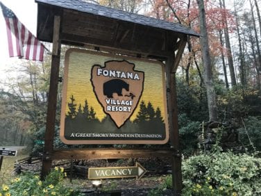
fontana village sign
Lake and GSMNP

Fontana Village - Marina

Fontana Lodge to the Fontana Marina Hike

The starting point is just uphill from Fontana Lodge. Your journey will end at the AT Junction just above Route 28 / Fontana Crossing.

This section generally follows old gravel roads from Fontana Village to the Fontana Marina and the AT Junction.  Scheduled for major trail renovation in the near future, this is an easy and fun hike with great views of Fontana Dam and an abundance of wildflowers in the spring. Although there are several water sources, camping in the roads is not advised.

Volunteers Needed! You could be a part of this future trail renovation. Go to VOLUNTEER to learn more about this and other trail projects.

Fontana Village - Marina Trail Information

See onX: Hiking Project for map and additional details:  Fontana Village to the Fontana Marina Hike.

Check for the latest trail conditions HERE

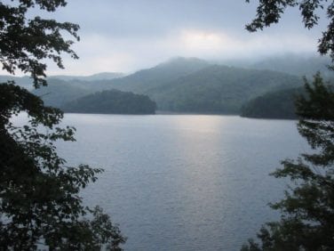
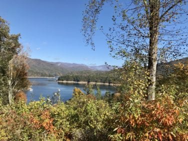
fontana lake view
fontana lake from benton mackaye trail

Fontana Marina - Shuckstack

Appalachian Trail Junction to Shuckstack Trailhead Hike

Your trek begins at the AT Junction just above Route 28 / Fontana Crossing and ends at the Shuckstack Trailhead in the Great Smoky Mountains National Park.

The trail goes near the Fontana Marina where you’ll find supplies and cold drinks. It then winds around the shore to pass the famous “Fontana Hilton” Trail Shelter — with all the amenities a hiker could want — showers, flush toilets and a cell phone charging station! Once refreshed, continue over Fontana Dam and up a Park access road to reach the Shuckstack Trail (AT) Junction.

You can return via the same path back to Fontana Crossing.

Before you go please consider becoming a member of the Benton MacKaye Trail Association. Your membership dues (Individual $20, Family $30 or Business / Corporate $50) support BMTA’s efforts to protect and improve the trail for your enjoyment. See MEMBERSHIP.

Fontana Marina - Shuckstack Trail Information

Check for the latest trail conditions HERE

The Benton MacKaye Trail continues straight along the Lakeshore Trail for 33.5 miles to the next trailhead at the Tunnel on the “Road to Nowhere” just outside Bryson City. This is the longest uninterrupted section along the BMT — and one of the longest in the East. Find out more about this long-distance hike at onX: Hiking Project:

OLYMPUS DIGITAL CAMERA
fontana dam

Fontana Dam - Lakeshore Trail

Fontana Dam and Benton MacKaye Trail / Lakeshore Trail Hike

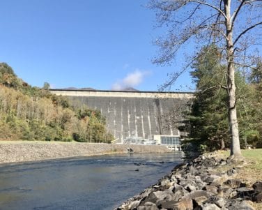
Fontana Dam is the tallest, most spectacular dam in the eastern United States. Both the Benton MacKaye Trail (BMT) and Appalachian Trail (AT) cross the 480-foot towering dam to enter the Great Smoky Mountains National Park.

The 2,365-foot-long dam provides electricity, flood control and recreation and created the 10,230-acre Fontana Lake … the national park’s southwestern boundary.

The hike begins on the Benton MacKaye Trail / Appalachian Trail as they cross Fontana Dam.

An easy to moderate hike (go as far as you want and return), it’s great for a morning stroll with the kids. From the dam, continue straight ahead on the BMT, up and down over small ridges, on the joint BMT and Lakeshore trails. The scenery varies from rock-strewn landscapes to small creeks lined with beautiful forest flora.

Several rusted chassis and auto parts lie semi-hidden at the side of the trail. They were left by their owners in the 1940’s. The area still was in the throes of the Great Depression – fuel and replacement parts were too expensive for many leaving the area.

This section of the combined BMT / Lakeshore Trail (from the dam to the next vehicular trailhead on Lakeview Drive near the Road-to-Nowhere tunnel) is 35 miles.

Recommended for several overnights, it’s a great route to follow through the ever-enchanting Smoky Mountains National Park.

After crossing the dam by motor vehicle or on foot, continue on the old paved roadbed 0.7 mi. to the parking area and trailheads for both the BMT and AT.

The route is well-marked by posts with green / white BMT signs and arrows. If day hiking, turn around and return at the intersection with Lost Cove Trail (5.2 miles) — or proceed another third mile to Campsite 90.

Fontana Dam - Lakeshore Trail Information

  • Distance: Hiker’s choice.
  • Difficulty Rating: Easy to Intermediate.
  • Benton MacKaye Trail Section #: 19e, 20 and 21a.
  • Dog Friendly? Dogs Not Allowed in the Great Smoky Mountains National Park.
  • Recommended Guide Book: Benton MacKaye Trail Guide – Smokies Section

See Onx: Hiking Project for map and additional details: Lake Shore Trail West.

Check for the latest trail conditions HERE

Lakeshore Car
Clare

Tips for Hiking With Kids

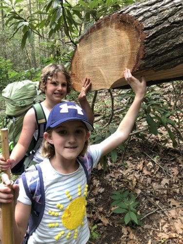
Have contingency plans – one kid might have the ability but just plain stops and won’t go further. So are some family members going to go on, while others wait or walk back? What’s the plan?

Take plenty of water and snacks. Carry a water filter and show the kids how to use it.

Carry small trash bags so the kids can clean the trail as they hike. However, bending over and picking up something in the woods may be harmful. Have kids point it out and Mom or Dad, wearing gloves, checks for things that bite and puts it in the bag of the little one who saw the trash. Biggest bag at the end of the hike wins. Be aware … after about a mile, Mom or Dad or both will end up carrying all the bags.

Have a change of clothes, dry shoes and towels in the car.

Point out “walk arounds” and encourage them not to use them. A “walk around” is where the trail has been obstructed by a tree or standing water and a hiker will walk around creating a wider trail. This increases erosion. Also discourage kids from taking a shortcut across switchbacks. This is dangerous and leads to severe erosion problems.

Encourage them to remove sticks and branches on the trail so that it will make it easier for the next hiker. Oh, and kick those “rollers” off the trail. A “roller” is a small, round branch that, when stepped on by a hiker, will roll and possibly cause the hiker to fall or sprain an ankle.

Carry a small first aid kit, whistle and bug spray.

No flip flops … everyone should wear sturdy shoes.

Feel and smell the leaves and wood but please don’t pick the wildflowers. There also is a fair amount of poison ivy in the Cherokee National Forest. Point it out and tell your kids not to touch it.

Point out obvious signs of trail maintenance, like trees cut out of the path or trails dug into the side of the mountain. Explain that these trails are taken care of by volunteers – that means they come out in the mountains and woods to work on the trails and don’t get paid.

Plan on bringing your kids on a trail work day. Check out Volunteer.

Benton MacKaye Trail Association invites your family to become a “Family Member”. Go to MEMBERSHIP for details.